Researchers from Advanced Space, Space Exploration Engineering and Texas A&M have demonstrated a way to navigate in cislunar space using only solar-array power data recorded during eclipses, according to a pre-print paper on arXiv. Tested on flight telemetry from the CAPSTONE Cubeat, the method timed the spacecraft's entry into and exit from the Moon's shadow to within 15 seconds of its actual path.
The paper, "Eclipse Observables for Navigation in Cislunar Space," is by Ian Down of Advanced Space, James McElreath of Space Exploration Engineering and Manoranjan Majji of Texas A&M. Down, the lead author, works at Advanced Space, which operates CAPSTONE.
How a power drop becomes a position fix
Every spacecraft already tracks solar-panel output, typically through Maximum Power Point Tracking (MPPT), an algorithm that orients the arrays toward the Sun to maximise the incoming radiation. Eclipses are the other thing every spacecraft experiences. Engineers usually try to avoid them, because the arrays stop generating electricity, the battery drains and the vehicle gets much colder.
The researchers treat the blackout itself as a measurement. Astronomers know the positions of the Sun, Earth and Moon years in advance, and so also know the shape and location of the shadows they cast. Each shadow has two nested cones: the penumbra, where the Sun is partially blocked, and the umbra, where it is completely cut off. When a spacecraft crosses into one of them, panel output drops sharply, but the electronics keep running on the onboard battery. By precisely timestamping when voltage starts to fall and when it recovers after the vehicle leaves the shadow, the team's algorithm maps those eclipse observables to a three-dimensional position. It needs no cameras, star trackers or radio tracking.
Because solar-array telemetry is already collected on virtually every spacecraft, the authors describe the technique as effectively zero additional Size, Weight and Power (zero-SWaP). It needs no new onboard hardware and is therefore low-cost.
Jagged lunar shadows and a 22,000-observation dataset
Getting the timing precise is the hard part. The Moon has no atmosphere, so its shadow is highly jagged and follows the mountains and craters on its surface; each such feature can shift the eclipse timing by a few seconds. Earth's shadow poses a different problem. The planet is slightly flattened at the poles, and its atmosphere blurs the Sun and enlarges the shadow, which makes it hard to tell which part of the planet the spacecraft is passing over.
To handle this, the team used a dataset of more than 22,000 historical observations of lunar craters being covered by Earth's shadow, collected by astronomers between 1842 and 2011. With it, the algorithm could map parts of Earth's shadow to specific ground features and refine the timing-to-location mapping.
CAPSTONE test and the strain on the Deep Space Network
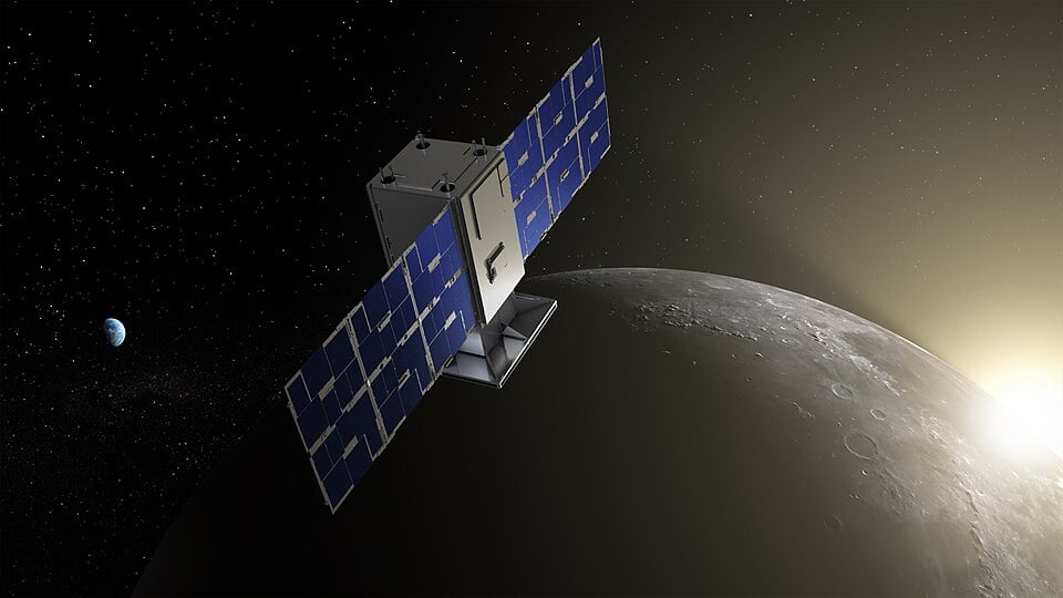
To validate the approach, the team used flight telemetry from CAPSTONE, a CubeSat mission operated by Advanced Space that was intended to test the orbit for NASA's now-discontinued Lunar Gateway. On January 11, 2026, CAPSTONE passed through the Moon's shadow. Its solar-panel voltage fell from 23V to near zero, then rose to 31V once the panels were back in sunlight. Using those timestamps, the researchers matched the spacecraft's shadow entry and exit to within 15 seconds of CAPSTONE's actual path.
They also simulated a spacecraft that missed a check-in with ground stations, so that its position uncertainty drifted by several kilometres. Processing the eclipse data, with no further information, cut that uncertainty by more than 60%.
The motivation is congestion. NASA's Deep Space Network (DSN) has tracked deep-space missions for decades but is increasingly overwhelmed by requests, which makes it harder to follow recently launched missions. As NovΔ mAInd reported in our coverage of the LightHOUSE laser-satellite proposal, the DSN originated in the 1950s, and its Earth-bound geometry contributes to delays and a growing backlog. Precise orbit determination for missions beyond low Earth orbit can take hours. MIT Lincoln Laboratory has proposed three high-orbit satellites, about 1.6 million kilometres above Earth, as one answer.
The eclipse method is a different kind of fix. The authors stress that it does not replace ground-based radio tracking such as the DSN, but offers a complementary safety net as more spacecraft venture beyond low Earth orbit. They propose it as a zero-cost augmentation to existing navigation systems for missions operating there.